Saturday, May 14, 2011

May 12, 13 and 14

May 12
Today was our six mile hike up Calf Creek to Calf Creek Falls. It was a gorgeous day to walk up the canyon with the new leaves on the Gamble Oaks and some wild flowers starting to bloom. The canyon walls were stunning. We did a lot of walking through sand and over rocks, sometimes not quite so sure where the trail was. Norm had the binoculars for bird sightings, Christy carried the lunch and read the brochure and I brought up the rear taking pictures. We had picked up a brochure at the beginning of the hike that pointed out the geology (just about heard enough of that), plants, beaver dams and signs of the Fremont Indians living in the canyon until about 1250. We could see three tall human figure petroglyphs on the rock wall across the canyon and beaver dams were in one wide area of the creek. I loved hearing the babbling sound of the creek and the birds calling to one another. The canyon walls became closer as we got to the end of the box canyon. We could hear the roar of the 126 foot falls before we could see it. Just as we got a glimpse of the falls, two mule deer walked into the creek making a great photo op. It was a HOT walk and we welcomed the shade and the spray from the falls as we sat and had a picnic. I think the water falls were the prettiest we have seen on this trip. By the time we got back we were hot and tired. The showers at the campground were fabulous! A little wine sitting in my rocking chair followed by a bar-b-q dinner and all was great with the world.


Calf Creek Falls


Mule Deer in the Creek with a Peek of the Falls Through the Trees


Calf Creek

Norm, the Leader of the Pack
 May 13
We drove the Scenic Byway Hwy 12 up to Torrey just outside Capital Reef National Park. This road is probably one of the prettiest I have ever driven. It starts out with a drive through amazing red rocks. We were stopped at an overlook looking down into a beautiful white rock valley. Before we knew it, we were taking the curves through the valley trying to catch all the amazing formations, many with a checker board look. One beautiful site followed another and we wound our way up to red rock cliffs and stopped for breakfast at the Kiva Koffee House and Bread and Breakfast. It is the only establishment along the drive and sits on the edge of a cliff looking out toward the beautiful rock formations. Every seat has a window view. After being fortified, we continued on to an early Mormon settlement of Boulder sitting in a green, green valley. It is so isolated that until the 1930’s, they got their mail by mules. In the 1930’s, the CCC built Hwy 12 bringing them a little closer to the outside world. We climbed up over 9,000 feet driving through huge Aspen groves. It must be spectacular in the fall. All this in about 45 miles.
We are staying at the Wonderland RV Park with full hookups before going into Capital Reef NP for three nights. We drove over to the campground in the park to find out how early we need to be there to get in line for a spot. They don’t take reservations and it can be tough to get a camp site. We have a plan: pack up and take down the Manor by 7:00, stop for breakfast and coffee to go, and get there before 8:00.
We had burgers at Slackers, the local burger joint and checked out the local grocery. Chris and I decide to drive up to Loa to a larger market to stock up and stopped along the way at a couple of Heritage Markers. One was an old picturesque wooden building, most are brick, that was a mill. It was used until the 1930’s when the railroad could bring in better flour for making bread. It still has all its parts including the cash register. Back in Torrey we stopped at a small log building from the 1870’s that was used both as the first Mormon Church in the valley and as the school. It is still used as a meeting place in the community. We drove up the street to a larger looking brick building that had been the next school but is now the School House Bed and Breakfast. It looked like a fun place to stay. Sitting in our rocking chairs looking across the green farmlands to red rock cliffs and snow capped mountains was a nice way to end the day.


View from Overlook on Hwy 12. Photo doesn't do it justice.
You can see the road we traveled on making its way through the valley..


View Along Hwy 12
 May 14
After a gorgeous day yesterday, this morning it’s raining. We took a scenic drive someone had recommended up to Fish Lake. We had to take a detour after I sat on my glasses trying to see a bald eagle sitting on her eggs in a nest through my binoculars. We drove up to Richfield remembering that it had a Walmart with a Vision Center. Glasses fixed, we picked up a picnic lunch and headed for Fish Lake. It is loop road but we found that the road was closed, probably due to snow. The lake was still frozen! The area around the lake has the largest living organism in the world! It is a huge grove of Aspen trees! I’m not sure how a grove of Aspen trees are a living organism but they were beautiful even without their spring leaves.
Dinner tonight should be very special. Christy noticed that Café Diablo was listed in the restaurant guide for the area as being the ”Best Restaurant in Southern Utah.” Norm looked it up online and found raving reviews along with it being listed as a place to experience in the “1000 Places to See Before You Die” book. We quickly called for reservations for 7:00 tonight. We took showers and got dressed up for the occasion. Check out the website for the menu. http://www.cafediablo.net/ Our dinner was amazing! The outside is not a head turner but as soon as we drove in we knew we had made the right choice to get a reservation. The place was humming! Every plate coming out of the kitchen was a work of art. We ordered margaritas and appetizers to start including free range rattle snake! We all even ordered dessert. They had to roll us out to our car. They are only open from April to October but manage to keep most of the employees from year to year. The owner chef went to culinary school in NY and made his way out west to be head chef at the Deer Valley Ski Resort, rated as the #1 ski resort in North America. After visiting Capital Reef he decided to buy an empty building in Torrey and start his own restaurant with a southwest cuisine. The rest is history. People come from Salt Lake and Provo on a regular basis. Our waitress was fabulous. It is a winner!!!!


Cafe Diablo


Wednesday, May 11, 2011

Snow Day

May 10
My cousin Tom’s reply to my blog: Tell Norm it is good to be genius.
It is very good to be genius and have someone notice.
But to be genius , have someone notice, and be toasty warm, well fed, and electronically connected while cozily nesting, all the while surrounded by sculpted geologic grandeur during a spring snow storm, that's greatness!


Just a few footsteps for a potty break.


You can actually see the snowflakes!


Happy Hour


Mexican Train Time - I Lost


Chris and I at Our Computers - note the snow outside
 With dark clouds looming overhead we made a trip to Ruby’s Inn right outside the park. We had noticed that they seem to have everything from motel, restaurant, gas station, horse stable, and a rodeo ground. It turns out that in 1916, Ruby and Minnie Syrett homesteaded land right outside what is now Bryce NP. They loaded a wagon with supplies and headed to their new land thinking they would be ranching. Going through Red Canyon was amazing and unexpected for them. A couple of months later a visitor from the town of Tropic stopped by and asked them if they had seen Bryce. “No, what is it?” The neighbor answered, “Just a hole in the ground but you should see it.” They got in their buggy that day and were surprised and amazed at what they saw. Soon they were showing off the canyon to others. Word spread and by 1919, they had pitched tents to accommodate travelers. By the next year they had built “Tourist Rest” right on the rim at Sunset Point. They soon added tent cabins and a dance pavilion. When Bryce became a National Monument in 1923, they had to leave their ‘resort’ behind and return to their ranch. Early in 1924, they decided to build an inn on their property and it is now quite a complex with the 5th generation being trained by the 4th. They have horseback riding trips, a rodeo show during the summer, a western dinner show and more. We enjoyed the laundromat and showers before having a yummy lunch at their restaurant. They have a full gift store with camping supplies and groceries. It would be a great place to stay if camping is not your thing. Kids would love it and Bryce NP is right down the street.

Monday, May 9, 2011

April 8
Today the weather is changing with wind and clouds coming in. We might had thunder and lightning by tonight with snow maybe tomorrow night. Spring is a slow process here. We drove down to Kodachrome Basin State Park on Hwy 12 east of the park. On the way we stopped at the Fairyland Lookout for another beautiful view of Bryce. We drove through the farming and ranching country that was settled in the 1870’s by the Mormons. Taking over the areas water supplies, the Paiutes were pushed out of the valleys. Ebenezer Bryce settled in the town of Tropi with his family in 1875 to harvest timber. His neighbors called the canyon behind his house Bryce Canyon.
Kodachrome Basin was named by a team from National Geographic who came to the area in 1948. Because of the beautiful colors and the ever changing light, they used the name Kodachrome after the new Kodak color film. It was pretty but small compared to what we have been seeing. We took a short nature trail. Utah and Arizona have really nice state parks with lovely camping facilities. They are usually small but have all the services in beautiful settings. Tonight we are going out for Mother’s Day dinner at the 1920’s Bryce Lodge. The dining room looks lovely with white table cloths and waiters wearing white shirts with black bow ties.


Kodachrome State Park


Pronghorn
 April 9
From shorts to fleece! We woke up to a beautiful sight with the trees covered with snow. There was at least 2 inches of snow on top of the Manor! We decided to take an unexpected drive through Red Canyon and then north along Hwy 89 to Richfield. That way we could see some new territory plus charge up the battery and not have to worry about running the heater later. We had seen the gorgeous Red Canyon with bright blue sky a couple of days ago and today had the chance to see it with snow. We stopped at the Visitor Center. They had great displays for children plus told the story of the Quilt Walk. The Quilt Walk revolves around the initial attempt to settle Panquitch, Utah in 1864. The first winter was brutal, food was scarce and the settlers were starving to death. A group of seven men, with a wagon pulled by oxen, set out to get food from Parowen, 40 miles to the west. In their weakened condition, the men struggled with every footstep, sinking up to their hips in snow. Eventually they abandoned the wagon and oxen and tried to continue. Finally deciding they could go no further, the held a prayer circle kneeling on a quilt. They realized they were not sinking into the snow. The men completed their journey by laying down quilts over the deep snow and walking across them, retrieving them and repeating the process over and over again. They made it to Parowin and back carrying the needed supplies on their backs. The trek became known as the Quilt Walk and is celebrated with an annual festival each year.
The long valleys along Hwy 89 going north were dotted with ranches spreading toward the mountains. Fields were already planted and green. Cattle and sheep were grazing along the swelling Sevier River. We drove through small, very small, towns stopping in Richfield for lunch. We looped around to the east and drove down the valley on the other side of the mountains back to Bryce. It was a beautiful ride with snow coming down now and then.
We are enjoying the comforts of home with the heater keeping us nice and toasty. Norm is a genius and has an extra battery set up in the Manor so we can charge our cell phones and run our computers without being hooked up to electricity. We are totally in the modern world. I’m not sure that is always a good or necessary thing but I do love having my computer and phone!

Snow!


Red Canyon


Red Canyon


The Genius


Christy with Her Bird Book and Me Sending a Blog - What a team!


Bryce Canyon

April 6
What a pretty drive we had today driving over the high plateau, across mountains and through Red Canyon with its hoodoos and arches to Bryce Canyon. It was a beautiful warm and sunny day so we didn’t waste anytime getting out to see some of the views along the canyon rim. Snow is in the forecast in a few days. What an incredible place. Those in the know say there is nowhere else on earth like it. My favorite breathtaking view was looking out to Bryce Amphitheater from Bryce Point. The limestone hoodoos look like a city shining in the sunlight. The definitions of the word hoodoo are: a pillar of rock, usually of fantastic shape and as a verb, to cast a spell like voodoo. The Paiute legend is that the pillars were ancient people who had done bad things and a coyote turned them into stone. Ten million years ago forces within the earth began creating what we have the pleasure to enjoy now. Of course it is an ever changing landscape with windows opening in the long reaching fins then eventually collapsing. New pillars form while others are disintegrating with the rainfall, snow and ice. At 8.000 feet plus, the park has an average of 200 days of snow or freezing temperatures. Nature is constantly at work. Along our drive we were lucky to see pronghorn, mule deer and Utah prairie dogs in the meadows.
Our campsite is large and sits up against a hill with pines and shrubs. We don’t look at our neighbors at all. The best part is NO caterpillars or other such creatures in large numbers. Having a glass of wine while sitting in the sun with Norm manning the bar-b-q is pretty special always a treat.


Bryce Canyon Overlook


Looking Out to the Amphitheater at Bryce Point
 April 7
We had planned to take our coffee up to Sunrise Point shortly after sunrise to enjoy the early morning color on the hoodoos. 9:00 wasn’t exactly early but the color was still amazing and a great place for a morning cup of coffee. Later in the morning Chris and I took the Queen’s Garden Trail down a mile into the hoodoos. Every step of the way was an amazing sight. I was snapping pictures right, left and center! Standing at the base of the hoodoos and fins looking up is totally different than looking down onto the amphitheater. Both are wonderful but I wouldn’t want to do one without the other. We even made it back up without too much difficulty. Walking a mile uphill at 8,000 feet burned a few calories. Later in the afternoon we all enjoyed a ride to the end of the road stopping on the way back at all of the lookout points. Each one was magnificent. By the time we were at the end of the road, we were at 9,150 feet with snow still on the ground.
Another late afternoon back at the Manor with a glass of wine in the sunshine and Norm at the bar-b-q turning shish-ka-bobs. Life is good!

Beginning Our Hike Down into the Hoodoo's


Hoodoo's


Down in the Hoodoo's


Down at the End of the Trail Looking Up at the Queen's Garden


Bryce Canyon at the End of the 17 Mile Drive at 9,000 + Feet.


Looking Through the Window


Thursday, May 5, 2011

St. George - Left Caterpillars Behind

May 3,4,5
Leaving Zion with all its beauty wasn’t easy but leaving the caterpillars behind took away the angst and we headed for St. George with glee. We were ready for a bit of a “city” stay. St. George has always meant “the best french fries ever” to me since the mid 60’s. Dick and I came through here going north on a camping trip and stopped for a burger and fries at a little burger stand. St. George was a very small town at that time. A couple of years later we came here again this time heading for the east coast. My brother David was with us and we had gone on and on about these fries. Sad as it was we couldn’t find the little stand. Now St. George has grown up and has 50,000 people. The new housing sprawl goes on and on. We did a walking tour of the attractive and vibrant Historic Downtown stopping at the first Mormon Tabernacle that was built in 1863. In 1861, Brigham Young sent 309 families down to start a community here to grow cotton. A year later 200 more families arrived. Everything was here for building with plenty of sandstone, wood, gypsum and lime. Soon homes and the Tabernacle were standing tall. In the group were folks of all trades from stone masons to farmers. It became a known as Utah’s Dixie with 1,000,000 pounds of cotton in the first crop. In its early days, the Mormons began trading produce for silver in the mining town of Silver Reef and developed a relationship with the local Catholic Father. He wanted to conduct High Mass for his Catholic miners and the Mormons offered their Tabernacle as the meeting place. The Mormon choir even learned to sing the High Mass in Latin! Today it is used as a meeting place for the community with other denominations using it for their needs as well.
Movies and popcorn was on our list. We saw “Water for Elephants” and thought it was great. The book was on all of our favorites list. “Soul Surfer” is in today’s plans along with grocery shopping and laundry. Being Cinco de Mayo, we are going out for Mexican food tonight. Next is Bryce Canyon.


First Mormon Tabernacle in Utah


Brgham Young's Summer Home


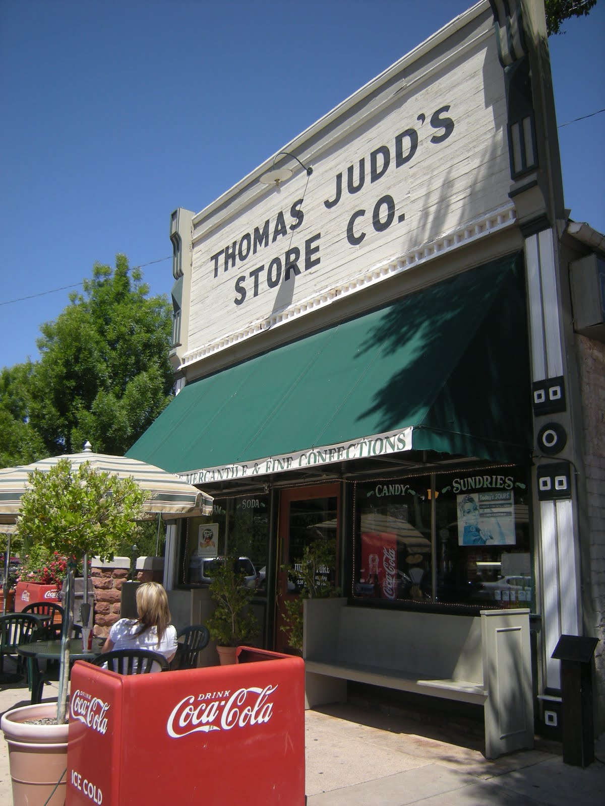
Judd's Store Still Managed by the Judd Family


Snow Canyon


Tuesday, May 3, 2011

Zion - Caterpillar Heaven

April 30
In the morning we drove to the east side of the park for a hike and some photo ops but dark clouds came over this part of the park so we decided to try again tomorrow. Instead we went west and spent the afternoon driving up Kolob Terrace Road going in and out of the park climbing in elevation to 7,000 feet plus. Unplowed snow kept us from going to the end of the road. Beautiful ice cycles glistening in the sun were hanging from the red rocks. Again and again beautiful views were surrounding us. An incredible long ridge of red rock cliffs were the topper. We took a short walk and had a picnic lunch in the car but we weren’t dressed for the 39 degrees temperature. We headed back down for nice warm temperatures in the valley.


Caterpillars Dance - Too bad Zoe wasn't here to capture it on video.

What a Spot for a Bar-B-Q


Pork Chop Dinner  Right Off the Grill - Eating in the wild is tough!


Ice Cycles


Beautiful Wildflowers Next to the Snow
 May 1
We drove to the east side of the park again and this time the sun was shining. Christy and I took the Canyon Overlook Hike just east of the tunnel up to the magnificent lookout standing on the edge of a 2,000 foot drop to the valley below. Looking out in every direction were cliffs in every shade of rust from pale almost white to deep deep rusty red. It was quite a site! The hike was a fun one as we clambered over rocks. At times we were hugging the cliff side as we carefully walked along. Railings were few and far between. We walked under an overhang with water dripping from the ceiling. We remembered hearing that it can take 1,000 years for rain falling on the surfaces at the top to percolate through the pouris sandstone down to the and find its way to the surface far below.
Farther down the road is Checkerboard Mesa. These amazing formations of naturally sculpted rock have horizontal lines that are the remnants of ancient sand beds. Crossing these are vertical lines that are fractures have been enlarged over the years by runoff from rain and melting snow. It makes an interesting checkerboard pattern on tall broad cone shaped rocks. We stopped at various places and had fun walking up the sides of the sandstone rock formations. While Zion canyon is gorgeous with its tall red cliffs and peaks, the east side has its own beauty with interesting rock formations rising up in all directions.
We took the shuttle to the end of the canyon in the afternoon to the Temple of the Sinawava and the Riverside Walk. Sinawava is a Paiute word for area of the good gods. Standing at the shuttle stop I was surrounded by tall cliffs feeling very small. A nice paved trail took us deeper into the narrow canyon with the Virgin River rushing by, water flowing over a 2,000 foot high cliff, and the sun shinning through the new spring green leaves. When the water level is lower and river nice and calm, you can walk even further up the canyon through the river on the Narrows hike. Pictures look beautiful but it isn‘t an option now as the water is flowing at 500 + feet per second. Wild flowers and ferns are just beginning to appear along the moist cliff sides. These small hanging gardens are the result of water flowing for up to 4,000 years through the sandstone to the Kayenta layer below. At this point it seeps out to form a nice wet habitat. Columbine was not yet blooming but we did see the pretty purple shooting star and delicate ferns hanging on the edges. We ended our lovely walk with an ice cream at Zion Lodge. We might have spotted California Condors but most likely turkey vultures swooping along the cliffs and sitting high up on a ledge. Nice way to end another day in paradise.

Canyon Overlook Trail


Standing on the Top of the World


Standing Over the Edge on the Overlook Trail


Checkerboard Mesa


Walking on the Rocks on the East Side of Zion


Riverwalk Trail - Water pouring down the cliff.


Riverwalk Trail


May 2
Reply from My cousin Tom on the caterpillar;
So the intrepid adventure/wanderer began to experiment in the fascinating world of possibilities related to fried, sautéed, boiled, toasted, roasted, mashed, ground, pureed, and smoked caterpillars. The ones she missed did turn into beautiful butterfly's, burp!
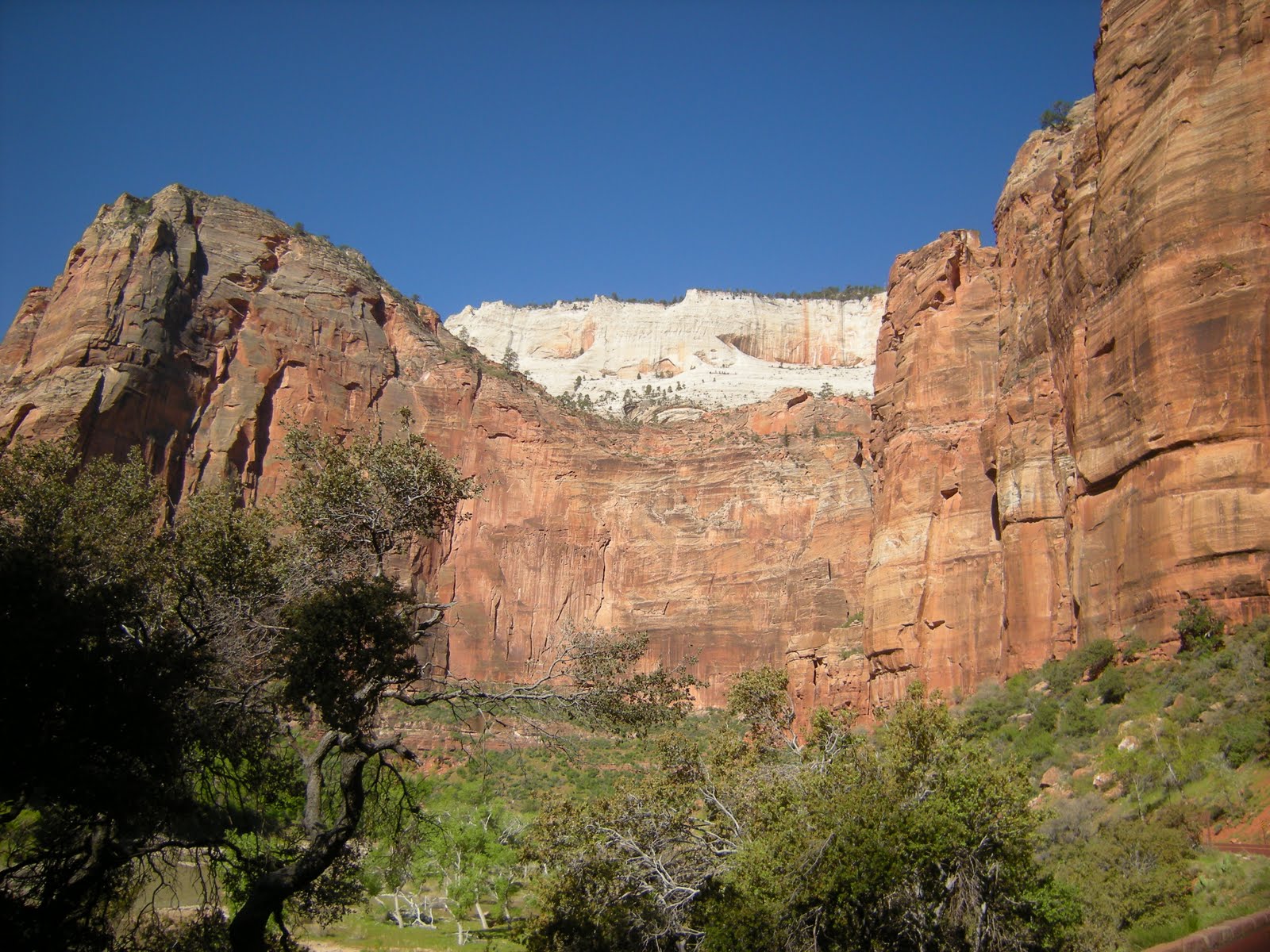
A 2 hour bus tour is offered by the park every morning. We signed up ahead and this morning hopped aboard with Ranger Bryan. We drove up Zion Canyon with Bryan giving us interesting information and entertaining us all the way. Much of the geology I was aware of but I didn’t know what the “grand Staircase” referred to. The top layer of strata of the Grand Canyon is the bottom layer of Zion and the top layer of Zion is the bottom layer of Bryce making the staircase as you go north. This canyon is made primarily of sandstone from the largest sand dunes in the history of the world. Layer upon layer was compressed from the pressure from above. Water did the rest of the work with the Virgin River carving these amazing 2,000 ft. Navajo sandstone walls. The lower levels of the canyon were once a sea forming and receding again and again. 2 million years later we can enjoy this amazing place. The humans that are tracking through these parks by the millions each year seem to have a reverence for the environment and are being good stewards of the land. We have not seen liter anywhere in these lovely places and people are staying on the trails with the help of reminder signs. We continually hear foreign languages all around us. What a fabulous way for Americans to share their country.
We went into Springdale for lunch and found Oscar’s, a terrific place to eat outside. We all had the special of the day - Ribs. We stopped at the market for some bottled water to find that it is $12.00 for a 24 pack. They certainly seem to be discouraging plastic throw away bottles!
Chris and I took the shuttle back up the canyon to the short Weeping Wall trail. It was a good example of rain water filtering through the sandstone and weeping down the face of the rock forming small hanging gardens. It was pretty but will be beautiful in a couple of weeks with more wildflowers. We went up the canyon a little further to the condor sighting area for one more try and saw the pair soaring! We had learned from Bryan that when the condors soar, their wings are laid out flat while the turkey vulture’s wings are in a “V” Shape. Of course they are twice the size with a wing span up to 9 feet. Turkey vultures were soaring with them and looked small in comparison. It was a treat to see them before we left. They are making a good comeback after being reintroduced to this area. This ends our trip to Zion. We are heading to St. George for three nights and planning to do some city things like see a movie or two. A little change of pace can be nice.
Angel's Landing - We could see people hiking along the saddle in the middle to reach the top of Angel's Landing. This is in the area where we saw the condors soaring.


The Throan and Organ Point - John Powell, a Methodist Minister and the Mormans are responsible for naming most of these formations. It is obvious by the names how awe struck they were.