Friday, August 12, 2011

Reunion

Rachel & Scott


Doug, Sawyer & Zoe


Legos in the Capbell Tent


Allison & Me


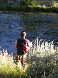
Jake Fishing


Logging Museum


Rachel & Me


Jordan's Birthday


Jake, Jordan & Pheonix Jummping Off the Bridge


Zoe & Jayden


Nash on Paddle Board / We all loved it!

Phoenix, Carter & Nash


Daves Night at the BBQ


Allison & Bryan


Jordan & Jakes Night at the BBQ


Allison and Jake

New photos

Thursday, July 14, 2011

Photos

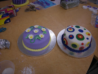
Mom, Here are some photos of Allison at our Cake Decorating class. Also, I put in a photo of Jake and Beth.


Tuesday, June 14, 2011

Reunion News

Hi Reunion Folks,
We stopped for the night at Collier Memorial State Park on our way home. It is really pretty and the campsites are nice and big. It should be in the 80’s and not rainy. We all have a drive to get there, so I know it will be hard for families to arrive early in the day. Chris, Norm and I will stay somewhere close so we can get a spot in the morning. If any of you are extending your trip and stay somewhere close by before coming to the reunion it would be great to get there early in the day. Both Bend and Crater Lake are fairly close by. We can’t save spots but the rangers have told us it does not fill up during the week and we are checking in on Thursday, July 21. Hopefully we have campsites in the same area. The rangers said the worst of the mosquito time is in June but still bring your mosquito stuff along. For all you guys who get bitten I hope they won’t be too bad.
 The campground is on the Williamson River and it is great for fishing. I’ll try to find out what we need for bait, licenses, etc. before we go. There is a trail along the river to Spring Creek and over to a Logging Museum. We will have a scavenger hunt to make the museum a fun plus a learning (the teacher in me) outing. There are day use areas along the river and the creek that would be fun for picnics and maybe some wiffleball. While it is a great fishing area, it’s not so great for swimming. The water for the creek comes from a spring and is about 42 degrees. Anyone can get there feet wet but it would be pretty darn cold for swimming. It is only 2 1/2 miles long and runs into the Williamson River making that cold also. The Williamson River was running pretty fast and might be fun rafting but it’s not a “kid take off on your own” kind of place. Up the road there is Fort Klamath with a small museum and a fish hatchery where kids can feed the large fish. Crater lake isn’t far. Rachel is talking about hiking down to the lake and taking a swim. It’s a tough mile back up but they did it last summer and thought it was fun. I think there will be plenty to do but it won’t be swimming like we have had before. Zoe, Christy and I will have lots of crafts and games for the kids. The reunion is all about us being together and connecting once again with family time. I can‘t wait to see everyone.Enjoy the few photos I took while we were there.

Campground Spot


The Manor


Williamson River From the Trail at the Campground


Spring Creek at Day Use Area


Spring Creek Again


Logging Museum


Logging Museum


Sunday, June 5, 2011

Yosemite

June 2
Ah, Yosemite. As we wound our way up and over Hwy 120, we dropped into view of waterfalls cascading over the granite walls, we all exclaimed in oohs and aughs at the same moment! We saw at least three water falls within seconds and still hadn’t entered the valley floor. With near record snowfalls and being the first of June, Yosemite Falls and Bridalveil Falls are thundering over the high granite walls in amazing beauty. The meadows on the valley floor are a brilliant green along with the new maple tree leaves. Dogwood is in bloom everywhere and to top it off the sky is broken up with white clouds! We loved the red rock and desert but coming into the tall pines and firs with the lush meadows and water running everywhere felt really good. We couldn’t get set up and have lunch quick enough before getting on the road. We took the loop hike to the Lower Falls and the view of Yosemite Falls. We could hear the roar of the falls as we walked toward them. I think I saw that roughly 2,500 gallons are pounding over Yosemite Falls each second. That’s like 2,500 basketballs shooting over the falls each and every second with a thundering force. With my eyes and ears taking it all in, it was quite an experience. Of course there are people everywhere to share the experience with me and cameras going off continually. No private time here! My camera doesn’t do the falls justice but it will be a reminder of the beauty and nature’s power. The river which was down to a trickle in October was now roaring over the rocks. We had only seen a trickle of water on the falls in October and that was only because it had rained the day before. Otherwise it would have been totally dry. These full falls and the green valley are what we returned to see and we weren’t disappointed! As we got out of our car at Bridalveil Falls, we noticed that some of the people were totally wet with the lucky ones wearing their rain jackets. We could hear the roar of the water load and clear. As we started up the walkway we heard such a loud noise. Later we figured it must have been rocks tumbling downstream and then cascading over the cliff or rocks falling off the cliff side. Thank goodness the pathway is paved because it was covered over by a stream of water. Christy’s new boots kept her feet nice and dry while mine were soaking wet. We were all glad to have our rain jackets! The spray bouncing off the rocks as the water hit the cliffs and then the pool at the bottom sent a spray that was like rain as we came closer to the view point. We not only heard and saw the gorgeous falls, we felt it. We drove up to Tunnel View where the valley is before you with Bridalveil Falls and Half Dome. What a sight that is. Knowing there are thousands of tourists like us in the valley, it looks like total wildness from the viewpoint where only wildlife would be wandering the valley floor.


Yosemite Falls


Lower Yosemite Falls


Getting soaked at Bridalveil Falls


Yosemite Valley


El Capitan
 June 3
We weren’t as lucky with the weather today and woke up to a cloud cover that never broke all day. I’m so glad we had our beautiful views yesterday with the sun shining. We wanted to repeat our walk up to Mirror Lake that we did in October. The lake was only a small pond and the river a small stream then. In June it was easier to picture the lake back in the late 1800’s being dammed up allowing tourists to paddle about in row boats. It was a beautiful walk in October but more so now. The river is raging over the rocks as it makes it way to the Merced River. Standing by the lake we looked up for a different view of Half Dome and on up the granite mountains toward Tioga Pass. After lunch we drove up to Glacier Point for the fabulous panorama view of Nevada Falls and Vernal Falls, Half Dome, and Yosemite Falls. We could hear the falls miles away across the valley! What a sight even though the gray skies didn’t make for good photos. We were up over 7,000 feet and there is still a lot of snow up that high. Because of the snow, the road only opened a week ago.
After dinner we went up to the theater at the Visitor Center to see a film called “Return to Balance: A Climber’s Journey’ with Ron Kauk, the climber, giving a live introduction and discussion after the film. The film is a work of art taking the viewer through the seasons of Yosemite highlighted with Ron Kauk rock climbing. He is master starting rock climbing back when he was 13. He made it look like a beautiful ballet. He related it to yoga. He brought in his deep connection with nature and Yosemite. It was a beautiful and moving film. We also made it over to Yosemite lodge to see the film Ansel Adams. In 1997 when this film was made he was looking back at the development of his career and the growth of photography being accepted in the art world. He went all the way back to his childhood as he reminisced. He sure had a twinkle in his eyes. He must have been quite a character. Norm had clued us in on the films and they were both terrific.


On Hike to Mirror Lake


Reflection Near Mirror Lake


Snow Near Glacier Point

Squirrel at Glacier Point
 June 4
Rain was expected today and by breakfast time it was here. We are nice and cozy as we look out into the campground but most of the campers are in tents! You can’t even have a fire in Yosemite until 5:00 in the afternoon. Tent camping in the rain just doesn’t look like fun. We decided to take the hour plus drive up to the Hetch Hetchy Reservoir which is fed by Tuolumne River. Christy has fond memories of their family’s first backpacking trip up there. They hiked along the lake and then up to the head waters of Rancheria Falls. With Bryan at only two or three years old and Doug at six or seven, they made the seven mile hike with over thirty pounds on their backs. They took everything they needed for seven days and had the time of their lives. It was such a success that they made backpacking their family vacation for years and years. When the kids were little they even made it on the cover of a backpacking magazine! It might have been this trip. The area is beautiful but the clouds and sprinkles didn’t make for the best first impression. It was quite the controversy back in 1913 when Congress authorized the dam to be built within the park in such a gorgeous valley. John Muir and others wanted the valley to remain untouched. Now there is a movement to return the valley to its natural state. After the San Francisco earthquake in 1906, the city was looking for a dependable water source and decided to push for the dam on the Tuolumne River. It was completed in 1923 and now supplies the San Francisco Bay area with its drinking water. Electricity is also generated.
I had made reservations for dinner at the Ahwahnee Hotel as a surprise and thank you to Norm and Chris for graciously taking me along on another dream adventure. What a beautiful dining room. We sat at the very table where Queen Elizabeth had sat on her last visit. It had an incredible view of Yosemite Falls! We have had an incredible journey and are still laughing and talking to each other after more than 4 amazing months on the road. Tomorrow we head north with a stop in Chico for a quick visit with Jake and one more stop at Collier Memorial State Park to check out the campground we picked for our family reunion in July. The next day we will be home! We are excited about getting back to our home bases and reconnecting with family and friends. My garden is waiting for some tender loving care. Norm and Chris are ready to get back to eBay.


Water Shooting Out of Hetch Hetchy Dam


Lunch By the Fire at a Lodge Near Hetch Hetchy


Dinner at Ahwahnee Hotel!


Saying Goodbye to Yosemite
 June 5
We met Jake and he introduced us to his friend Beth. Sitting outside for a Mexican dinner downtown was delightful. It was wonderful to meet Beth and get to know her a little bit.


Wednesday, June 1, 2011

May 29,30,31 & June 1

May 29
Last night we went to Buck’s for dinner and sat out on the patio. It was Prom night at the local high school and the kids were all spiffed up with their dates having dinner when we arrived. The owner chef was a local guy who left town years ago to go to culinary school in L.A. and got early training at a Four Seasons. After being head chef at a couple of upscale restaurants, he came back to Moab and opened his own place. He has quite a reputation. The food was superb.
Wind, wind, and more wind! All night we had gusts that felt like the Manor was going to move to the next site! By the afternoon the air was so thick with dust that the sky was brown. Grit got in my mouth, nose and eyes. It was terrible! On top of all the wind, it was hot so we had to have the windows open to sleep. The Manor had a layer of red sand everywhere. It was our worst weather on the entire trip. Luckily the wind in town was a little better for the Art Festival. We had a fabulous breakfast at the Jailhouse CafĂ©. Among other things in the building’s history, it had been a Court House and jail. It reminded me of my restaurant in Cambria, Creekside Gardens, with lots of outdoor seating, great food, and friendly service. We listened to some of the music at the festival and enjoyed walking around the booths. It was a mixture of quality and funky. The last thing on our list was to take the short 18 mile ride out Hwy 279 toward the potash beds. One area along the road was lined up with people rock and cliff climbing. It looked like a great place to learn. The road followed the Colorado River as it continued south toward Canyonlands NP. We saw dinosaur prints! With all the rock movement over the centuries the big slab of rock is now on a slant and the prints were easy to see. We scoped out the restaurants in town and decided on having an early dinner at Zak’s. With nothing else to keep us in town, we headed back to the campground and miracle of miracles, the wind soon died down. We spent a good deal of time wiping down the Manor to get rid of the thick layer of sand that was covering everything. I think the sand will keep showing up for a while. When we got the cards out for our nightly games, the cards had grit on them!

May 30
After four months of travel, we headed back west across Utah to Ely, NV. We were dreading the trip thinking it was going to be long with boring scenery but were pleasantly surprised with a beautiful drive. As we came over a hill before crossing the border into Nevada, we had an amazing view before us of the gorgeous snow covered mountains in Big Basin National Park. Mt. Wheeler is over 13,000 feet and the tallest mountain in Nevada. We stopped in Baker for lunch before driving up the Visitor Center. We stopped at one of two places in town for lunch and were offered a choice of a meatloaf sandwich or a burger. The meatloaf was really yummy. Some college age kids were sitting there with their computers and books taking their lunch break from their jobs with the Conservation Corps. The National Park looks like a great place to spend a couple of days. It has a tour of Lehman Caves and the road up Mt. Wheeler must be beautiful. Nevada is the most mountainous state in the U.S. with the entire state forming a big basin with all the river water flowing to the center. None of the rivers drain into the Pacific or the Gulf of Mexico. It actually has over 90 basins with one mountain srange after another. Diving through Nevada will be up over a summit and down into a valley time after time. The area is so green and the mountains are snow covered and beautiful!

Casino From the Good Old Days in Ely
May 31
We had another pretty drive today driving across Nevada to Carson City. We have been traveling on "Hwy 50 - The Loneliest Road in America." It was a pretty lonely area of the U.S. with only a few ranches off in the distance and not many cars on the highway. We were there in time for lunch. We didn’t feel like visiting a museum so Chris and I did a little shopping in the afternoon. Chris found some new hiking boots that seem to be a perfect fit. She can try them out in Yosemite. We got a recommendation to try Red’s Old 395 Grill. The building itself was an architectural treat with a western look. Inside was a real museum of wagons, buggies, large farm equipment and old fire wagons hanging from the ceiling. They Had a huge restored 1923 Monach Steamroller that is one of two in existence. This one was used to pave what is now Wall Street in New York City. They moved it onto a cement slab and built the restaurant around it! The Host Stand at the front was salvaged out of St. Francis Hotel in San Francisco following the earthquake in 1907. The list goes on and on. The “Greatest Bar on Earth” features 101 different beers. Norm had a great nut brown beer from England. The food was just as great as the atmosphere. It turned out that our server was the niece of the builder and had lots of info for us. The owners are three guys from Chico. Among other restaurants, they own The Bear in Chico.

June 1
Had a short drive along Lake Tahoe and down to Jackson on HWY 49. Tahoe was beautiful but we had snow! Some of the homes along HWY 50 looked like they were still snowed in from the harsh winter. We had hoped to drive over Tioga Pass and down into Yosemite but the road is still closed. It usually opens by the third week in May but they had almost record snows this year so we took the long way around. It is raining today but we got our groceries for Yosemite and had a quite afternoon. We are staying at the Jackson Rancheria Casino and RV Resort.We staryed at this delux spot in October when we were exploring the gold country along Hwy 49.


Sunday, May 29, 2011

May 27/28

May 27
We had a lazy day today with a little shopping in Moab, lunch at the local brewery, and reading time in the afternoon. Every other vehicle in Moab is a 4x4 and the place is hopping with the Memorial Day weekend. After cooking three meals a day for a week, we decided eating out in Moab would be a nice change. The Sunset Grill high up on the hill overlooking Moab and the red rock cliffs was our choice for dinner. It is in the home that Charlie Steen built in the fifties after making it big in uranium mining. The house is three stories and a little tired at this point but it must have been quite the place in the fifties. He had a colorful past working as a geologist in South America and then in the oil fields in Texas. He ended up getting fired for insubordination and nobody would hire him. In 1950 he came out west after hearing that the government was subsidizing uranium mining. He and his family lived in a trailer and then a tarpaper shack as he continued drilling and coming up with nothing. He couldn’t afford the Geiger counter others were using. The story goes that two years later he went into Moab for gas with rock he had drilled out and put in the back of his beat up station wagon The gas station attendant came out with a Geiger counter and it went crazy! He had just found the largest concentration of uranium in the four corners area and became a multimillionaire over night. He spent like crazy. One story is that he couldn’t get good TV reception so he would fly over Moab in his private plane so his kids could watch their favorite TV shows. The story on the back of the menu ended with his move to Colorado, but the reality was that the money ran out and other ventures failed causing him claim bankruptcy in 1968. He must have had quite a ride living high while the money lasted! It is now a restaurant with every seat having a great view.
May 28
We had breakfast in town and headed north to make a circle drive up the Scenic Byway on Hwy 128 along the Colorado River. The river is 1,450 miles long, supplies 29 million people with water and irrigates 3.5 million acres of farmland. It has transformed desert land into cities, farms and recreations areas. Even now when it is running so high and fast it is hard to believe it can benefit so many. The Tamarisk plant now lines the river banks and is a worry at this point. It drinks about 17,000 gallons of water a day from the river! It is an invasive plant that made it’s way from Asia in the 1940’s. An eradication project has been set up but it must seem overwhelming. We drove up the river as far as the Dewey suspension bridge. It must have been quite a project when it was built in 1916. It had wooden planks and was strong enough to hold six horses, three wagons, and 9,000 pounds of supplies per crossing. It burned in 2008 and is now just a skeleton. There are still a couple of the original boards attached. We drove back to Castle Rock and Red Rock Cliff Resort. So many movies, TV shows and commercials were made in this area and the resort holds the memorabilia in a movie museum. With John Ford beginning to make films in the area in 1939, George White, a local Utah boy, founded the Moab to Monument Valley Film Commission in 1949 with the filming of Wagon Master. It holds the title as the longest running film commission in North America. Movies like Indiana Jones, TV shows like MacGyver, and the Malboro Man commercials all have some the area’s landmarks as their backdrops. It continues to help this area economically with locals being hired to build sets and play bit parts in many of the films. The museum did an excellent job showing how the locals have been involved. The resort is right on the river at a class 3 rapid. They offer a delicious Bar-B-Q lunch stop for visitors like us and river rafters. We sat on the grass having our burgers and looking out at the river and red rock cliffs. We watched a couple of groups go over the rapids as they screamed with delight. It brought back memories of our rafting trips. The circle drive took through Castle Valley and up into the La Sal Mountains.


Look who we ran into!

Rafts Lined Up along Colorado River - Red Cliff Lodge


WildFflowers and Cactus Are Blooming


Thursday, May 26, 2011

Canyonlands

May 24
We drove up the road a few miles to Archview RV Park for the next couple of days so we can see Canyonlands. The only campground in the northern part of the park has only 12 sites and no water. We decided full hookups was the way to go! We drove in the park to the Visitor Center and got acquainted with this part of the park. We had been to the southern section last week when we saw the needles area. Later in the afternoon Christy and I drove up to Green River to see the John Wesley Powell Museum. The town got a zero in our book but the museum was great. It gave and excellent history of Powell’s life including his journey down the Green and Colorado Rivers in 1869 and again in 1871. He started his incredible trip clear up in Wyoming. But is also included an all inclusive history of the Green River. Very interesting.
May 25
Canyonlands NP preserves canyon after canyon on the Colorado Plateau for us to marvel at. It is divided into three areas with the Needles to the south, the Maze to the west of the Green River and the Island in the Sky area in the center high above the Colorado and Green Rivers. It has an amazing dirt road that skirts the entire park 1,000 feet below along the White Rim. You have to make a reservation to take the two to three day trip with a jeep. Norm is already looking into a 4 wheel drive vehicle. We have put the jeep trip on our list for “some day.” We enjoyed the rim today with magnificent vistas of canyons on both sides of the road. After stopping at a couple of viewpoints, we took the easy .5 mile walk out to Mesa Arch. The view through the arch out to the canyon and La Sal Mountains was spectacular. At sunrise the arch glows with oranges and golds. Too bad I won’t get that camera shot but sunrise is at 6:00 now! Our get up time is closer to 8:00. Looking through the arch you can see Washer Woman’s Arch is the distance. Our next hike was down the road to White Rim Overlook with a two mile hike of vista after vista of canyons and the Colorado River. Standing at the end of the trail along the cliff we could see for miles. It looked like you could touch the snow covered mountains 35 miles away. We got our first real good glimpse of the Navajo stone white rim that winds in, out and backwards 1,000 feet below the rim we were standing on yet 1,000 feet above the two rivers. Looking down on the road it was fun imagining the jeep trip we will make someday. There was a nice picnic table waiting for us when we got back to the parking lot. At the end of the road we took the two mile hike out to Grand View Point. We could see both the Green River and the Colorado River and the canyons they formed before coming together at the Confluence further down the canyon. From then on it is the Colorado river making its way toward Las Vegas. The rivers are calm and meandering until they come together and then it is one wild ride for about 15 miles of rapids. River rafters have to be ready for rapid after rapid as the river heads south. The views were amazing at the point. We were standing on a rock high above the valley floor (2,000 feet) looking out in at least an almost 300 degree circle out to canyons clear down to the Needles area in the far distance. Three snow covered mountain ranges were framing the canyons. What a sight! After climbing up and down stairs and over and around boulders with our three hikes, we decided to take the last scenic road out to Upheaval Dome tomorrow.


Chris and Norm at Mesa Arch


Mesa Arch Looking Out to Washer Woman Arch and Canyons


Chris and I at tthe Lookout Down to Shaffer Road


Looking Down 1,000 feet to the White Rim and the Jeep Road
This is on the Colorado River side of the Island in the Sky.


Chris and Norm at Grand View Point


Me at Grand View Point with the Canyons Behind Me 

May 26
We started our day with a drive out to Dead Horse State Park for the incredible view of Canyonlands NP. I was disappointed with a thin cloud layer that was blocking the good light. It looked flat and drab compared to what we had seen yesterday. With good light it would be spectacular. It had great views of the Colorado River and also views of brightly colored potash pools. As they are processing the pot ash and evaporating water from large pools, blue die is added to the water. There was a display of Serena Supple’s paintings in the gallery at the Visitor Center. We have enjoyed seeing her work since our time in Zion. I bought one of her pieces to frame. I’m not crazy about the legend of Dead Horse Point. In the 1800s, cowboys used Dead Horse Point to catch wild mustangs. With sheer cliffs on all sides and an access only 30 yards wide, the point made a perfect horse trap. Cowboys herded horses onto the point and built a fence across the narrow neck to create a natural corral. According to legend, a band of horses left corralled on the waterless point died of thirst within view of the Colorado river 2,000 feet below.
We drove back over to Canyonlands NP to take the road down to Upheaval Dome. It was a short hike to the overlook and were we ever surprised when we climbed up and over a boulder and looked down into the large crater. In the center, the Chinle green rock was spiking up in such unusual formations. It looked like it could be a sci-fi movie set. My camera just doesn’t pick up the brilliant color and formations. Geologists have studied it and much has been written as to how it was formed with no firm agreement. Did salt push up under the rock layers and then dissolve, leaving the rock to collapse into the void? Or, is this the site of a meteor impact? The origin is still hotly debated. Chris and I both go with the salt theory. We met Norm back at the picnic area for lunch before heading back to the Manor and showers.
We began wandering the canyons and red rock of Arizona and Utah way back in the middle of March and have marveled at every one! Sedona, Flagstaff area, Petrified Forest, Canyon de Chelly, Monument Valley, Grand Canyon, Zion, Bryce, Grand Staircase of Escalante, Capitol Reef, Natural Bridges, Arches and Canyonlands have made a marvelous journey!

Colorado River and Canyonlands from Dead Horse Point


Canyon and Pot Ash Pools


Upheaval Dome
It was a brillant copper green color.


Me at Upheaval Dome Wishing I Had a Better Camera